Library of Codes
FBCI gathers the best examples of form-based codes from communities across the United States and abroad. The codes represent a variety of community types and applications of form-based standards. Click on the Show Search Options button to search the library by phrase, location, Driehaus Award recipients, and the categories described below.
- Physical Context: size or type of government entity
- Organizing Principle: underlying organization for the code standards
- Implementation Method: how the code standards operate within the zoning ordinance
- Development Type: development types impacted by the code standards
- Special Features: unique code attributes or awards
Columbia Pike Code and Plan
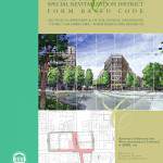
Columbia Pike was the most underdeveloped area in a county that is otherwise built out. Located in an urban county that has seen explosive growth in recent decades, Columbia Pike, (a 3.5-mile urban…more
Code Documents
Daufuskie Island Code
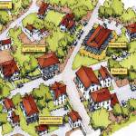
Based on the SmartCode, the Daufuskie Island Code is uniquely structured by defining a hierarchy of regulating levels starting with Conservation and Urban Sectors, followed by Place Types, Zoning Districts, Street Types, and…more
Code Documents
Highland Park Neighborhood Plan Form-Based Overlay
The Highland Park Neighborhood form-based code overlay specifies five sub-districts based on frontage types while each sub-district regulates for front setbacks, frontage enclosure, building heights, parking locations and parking access with detailed diagrams…more
Code Documents
Birmingham Downtown Overlay District Code
The Downtown Birmingham Overlay District is a mandatory integrated and text-based form-based code. Although there are no diagrams in the adopted code and no illustrations, the code has been part of a highly…more
Code Documents
Canton Village Districts Code
 **Driehaus Honorable Mention**
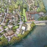
This code was adopted in 2018 for a suburban corridor linking established historic village centers in western Connecticut. Prior commercial strip zoning on State Route 44 is now pre-approved for higher density, mixed-use development…more
Clark County, Highway 99 Subarea Plan
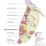
Hwy 99 Subarea Plan in Clark County, WA is a form-based code for the historic Hazel Dell unincorporated area. The Subarea Plan is subdivided into 4 types of Planning Areas of varying urban intensity that include neighborhood centers…more

